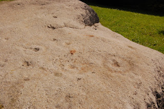

It doesn't seem like cup and ring territory, no height nor grave to accompany this one. I would be interested to know of any other C+R markings low down by large rivers, I know of quite a few standing stones beside rivers (the Devil's Arrows for example) but no rock art. The stone was placed in a rock garden at Kirkstall Abbey, until it was moved back to Horsforth to accompany the millenium stone opposite the museum, slightly further up the hill but still not probably it's original height.


Cup and ring marks also exist on stones in woods close to Horsforth station, near where the youthful viking head watches over the southern entrance to Bramhope tunnel. Perhaps the rock was carted down from one of these higher points during the building of Low Hall in 1575, especially as there was a quarry near here on the 1851 OS map.
Also near the Horsforth railway line is a place called Troy, now a housing estate. It shows on the1851 map as open fields, perhaps this has some history as the site of a labyrinth?
g!Wk~%24(KGrHgoOKjUEjlLmTEG6BKpzcn6wsw~~_35.jpg)
No comments:
Post a Comment